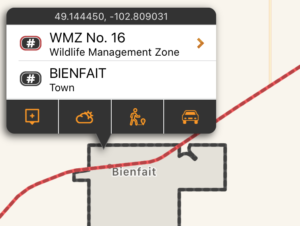
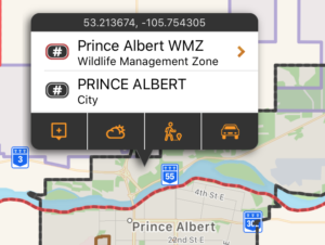
In App Purchases
Alberta County Landowner Maps
iHunter Alberta offers county landowner maps for sale within the app.
To use these layers on your map, first make sure you have iHunter AB:
Then add individual maps for between $9.99 and $30.99 depending on the county.*
* For a limited time you can save $2 by purchasing the map while using the iHunter Web app.

Select your county
Alberta is split up into numerous counties, which each produce their own landowner maps to show who owns which parcels of land. Open the Map Layers panel in the bottom left corner of the map, and tap or scroll to the Landowner Maps section. Tap on the map you are interested in to view more details.

Confirm boundaries and purchase
Turn on the switch for Show Boundary and then tap Zoom to boundary to make sure that it’s a boundary of the landowner map is one that you are interested in. You can also tap within the bounds of a county and the boundary will be shown on the map (dashed blue in color).
Landowner maps are sold on a county by county basis (not by WMU) and purchases work just like a paper map – you get the version you purchased for as long as you want to use it. Once a new map is available you can purchase that to get the latest information. Prices range from $9.99 to $30.99.
Available maps
- MD of Acadia (2022)
- Athabasca County (2024)*
- County of Barrhead (2023)*
- Beaver County (2025)
- Big Lakes County (2023)
- MD of Bighorn (2022)*
- Birch Hills County (2024)*
- MD of Bonnyville (2024)
- Brazeau County (2025)
- Camrose County (2025)
- Cardston County (2024)
- Clear Hills County (South) (2023)
- Clearwater County (2020)
- Crowsnest Pass (2024)*
- Cypress County (2023)*
- MD of Fairview (2024)*
- Flagstaff County (2024)
- MD of Foothills (2023)*
- County of Forty Mile (2024)*
- County of Grande Prairie (2024)*
- MD of Greenview (2024)
- Kananaskis Improvement District (2009)
- Kneehill County (2024)*
- Lac La Biche County (2023)*
- Lac Ste Anne County (2021)
- Lacombe County (2024)
- Lamont County (2024)*
- Leduc County (2021)*
- MD of Lesser Slave River (2023)*
- Lethbridge County (2024)
- Mackenzie County (2024)
- County of Minburn (2024)
- Mountain View County (2024)
- County of Newell (2024)*
- County of Northern Lights (2024)
- Northern Sunrise County (2024)
- County of Paintearth (2024)
- Parkland County (2023)*
- MD of Peace (2022)
- MD of Pincher Creek (2020)*
- Ponoka County (2025)
- MD of Provost (2023)*
- MD of Ranchland (2024)*
- Red Deer County (2024)
- Rocky View County (2023)*
- Saddle Hills County (2024)
- Smoky Lake County (2024)
- MD of Smoky River (2025)
- Special Area No. 2 (2023)
- Special Area No. 3 (2023)
- Special Area No. 4 (2023)
- MD of Spirit River (2024)*
- County of St Paul (2024)*
- Starland County (2024)*
- County of Stettler (2024)
- Strathcona County (2021)*
- Sturgeon County (2023)
- MD of Taber (2024)
- Thorhild County (2021)*
- County of Two Hills (2023)*
- County of Vermilion River (2023)*
- Vulcan County (2023)*
- MD of Wainwright (2024)
- County of Warner (2023)
- Westlock County (2023)*
- County of Wetaskiwin (2024)
- Wheatland County (2024)
- MD of Willow Creek (2024)*
- Woodlands County (2024)
- Yellowhead County (2024)*
* Developed by the iHunter team independently.
Alberta Public Lands Subscription
The Alberta Public Lands subscription includes 6 different map layers: Agricultural Lease Land, The Alberta Green Area, Vacant Disposition land, Huntable Public Parks, Restricted Access Land, and Registered Fur Management Areas.
To use these layers on your map, first make sure you have iHunter AB:
Then either try it free for 3 days or subscribe for only $9.99 per year to benefit from the layers being updated annually.
Agricultural Lease Land
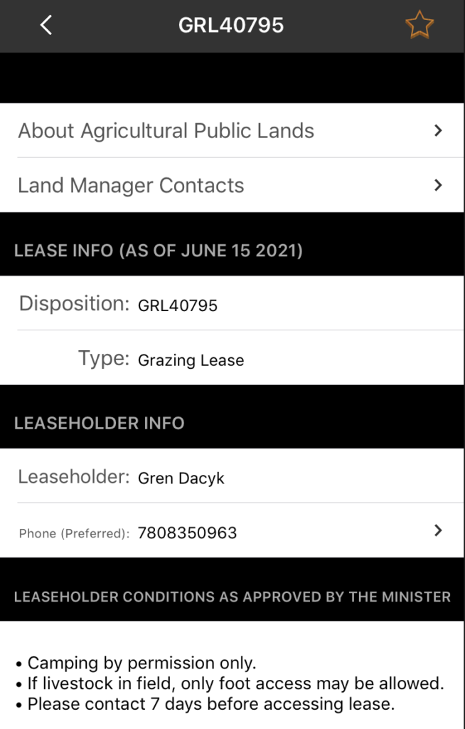
There are over 6000 agricultural public land dispositions (leases) that are also available for public access activities such as hunting (subject to restrictions). These lands include Grazing Leases (GRL) and Farm Development Leases (FDL), which typically require users to contact the leaseholder prior to access. Grazing Permits (GRP), Provincial Grazing Reserves (GRR), Forest Grazing Licenses (FGL) and Cultivation Permits (CUP) require basic conditions to be followed, but do not require contact (unless specifically listed). All of these leases have their boundaries shown on the map and are searchable in the Agricultural Lease Land menu. By tapping on the lease you are interested in, or selecting it from the search menu, you can see the leaseholder contact info and any restrictions that are in place.
These areas are shown in a teal on the map and are built into the app as part of the Alberta Public Lands Layers. They can be used even without cell coverage.
The “Green Area”
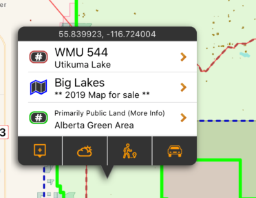
The Boundary for the Green Area of the province can also be shown. This is primarily public land, but some areas are under disposition (lease) and approximately 1,330 quarter sections and scattered small pockets of private land also exist. The Green Area is provided as a guideline, but does not indicate that you have permission to access all land within it.
The area is shown in green on the map, and are built into the app as part of the subscription. They can be used even without cell coverage. The boundary is quite large, and enabling it will slow down the app and reduce performance.
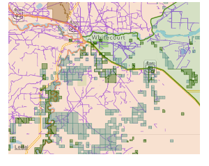
Vacant Disposition Land
In addition to the larger tracts of land shown in the other areas, vacant disposition land can also be shown. This includes leased public land like Pipeline Agreements, Easements, and Licenses of Occupation. These ‘Vacant Public Dispositions’ may be accessed by other users, as long as no development is occurring or is likely to occur within 90 days (or the road allowance is locked).
The are shown in purple on the map (when turned on), but do not have additional information other than the boundaries. They are not usually large tracts of land, but help with finding cutlines and other utility clearings. If they overlap other disposition types (like agricultural lease land) the restrictions of the overlapping lease take precedent. These boundaries are not built into the app, and are downloaded (and cached locally) as the area of the map is viewed.
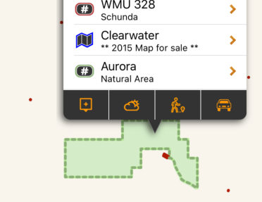
Huntable Public Parks
The Huntable Public Parks layer is made up of three types of public land that are all accessible and allow hunting: Natural Areas, Wildland Provincial Parks, and Wilderness Parks. Some parks may have special restrictions such as firearms limitations or restricted areas, but in general they allow hunting. Natural areas may overlap with Agricultural Lease Land, and are subject to the access restrictions of the lease.
They are shown in dark green on the map, and are built into the app as part of the subscription. They can be used even without cell coverage. Tapping on the area will give additional information or restrictions within the park.
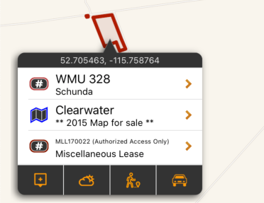
Restricted Access Lands
Although there are vast expanses of public land in Alberta, some parcels are used by the province or leased out for other purposes (mining, exploration, airstrips, etc). This layer maps out those parcels of Public Land that do not allow public access or have access restrictions (for the purpose of hunting, or otherwise). The Disposition Identifier listed can be used to discuss access restrictions with the Alberta Environment and Parks.
They are shown in dark red on the map, and are built into the app as part of the subscription. They can be used even without cell coverage. Tapping on the area will give information on the restrictions of the boundary.
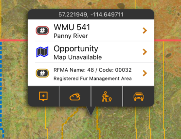
Registered Fur Management Areas
A Registered Fur Management Area (RFMA) is a parcel of public land, the boundary of which is described on the Registered Fur Management Licence.A Registered Fur Management Licence permits the licence holder to hunt and trap fur-bearing animals on the lands described on the licence.
They are shown in yellow on the map, and are built into the app as part of the subscription. They can be used even without cell coverage.
BC Public Lands Subscription
The BC Public Lands subscription includes 8 different map layers: General Use Crown Land, Private Land, Conservation Lands, No Hunting Zones, Crown Lease Land, Municipalities, Parks and Protected areas, and Recreation Sites and Trails.
To use these layers on your map, first make sure you have iHunter BC:
Then either try it free for 3 days or subscribe for only $9.99 per year to benefit from the layers being updated annually.
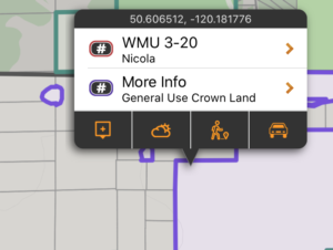
General Use Crown Land
94% of British Columbia is made up of public land, and the vast majority of this land is publicly accessible. By taking the land boundaries of BC and subtracting out the boundaries of all private land, conservation land, parks, protected areas, reserves, leases, and other federal land, we derived the ‘General Use Crown Land’ Layer.
There may be additional access restrictions on this land that are not documented in openly available GIS layers, and it is the users responsibility to obey all posted restrictions in the field. Although we have done our best to ensure this is accurate, discrepancies may exist. This layer should be used as a guideline only.
These areas are shown in a purple color, and are built into the app as part of the subscription. They can be used even without cell coverage.
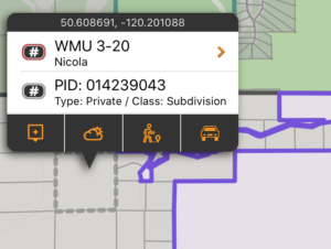
Private Land
Although making up only 6% of land in BC, private land is important because permission is required to access it. Knowing the size and shape of a piece of land makes it easier to discuss with a landowner, and being more informed could help with obtaining permission.
These areas are shown in a grey with a semi-transparent white filling the areas on the map. Each time a new area of the map is viewed, or a new zoom level is looked at, that portion of thelayer needs to be downloaded (requiring cell or Wifi service). Once downloaded, those tiles are cached on device for future offline use.
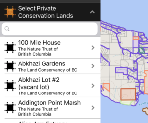
Conservation Land
Many parcels of private land are owned by Conservation organizations such as Ducks Unlimited, Nature Conservancy of Canada, The Nature Trust of British Columbia, Central Okanogan Land Trust, and the Denman Conservancy Association. This layer maps and lists these private conservation lands in a searchable manner, and provides links to access conditions for those lands. Public access varies from organization to organization, and the user is responsible for determining access using the links provided.
These boundaries are shown in pale orange on the map, and are built into the app as part of the subscription. They can be used even without cell coverage. Tapping on the area will give additional information about the selected conservation land.
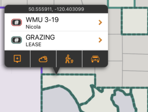
Crown Lease Land
Crown Land Lease is a type of land tenure issued under the Land Act. A Land Act Lease is issued where long term tenure is required, where substantial improvements are proposed, and/or where definite boundaries are required in order to avoid land use and property conflicts. The tenure holder is granted the exclusive use and enjoyment of the area. The tenure holder also has the right to exclude or charge the public for use of the land and/or improvements, when this is consistent with the terms of the lease. Generally speaking, permission is required for access and should be treated much the same as private land.
These boundaries are shown in teal on the map, and are built into the app as part of the subscription. They can be used even without cell coverage. Tapping on the area will give additional information about the lease type.
Municipalities
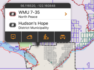
Municipalities have the authority to enforce shooting and hunting restrictions within their jurisdictions. By having these boundaries mapped, you can assess whether you are within the municipal boundary and subject to its bylaws.
They are shown in dark grey on the map, and are built into the app as part of the subscription. They can be used even without cell coverage. Tapping on the area will give municipality name and type.
No Hunting Areas
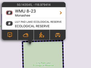
Some land designations forbid hunting by definition. Those area designations included in this layer are Ecological Reserves, National Parks, National Wildlife Areas and Migratory Bird Sanctuaries.This is not a complete listing of every parcel of land the dis-allows hunting, as that is an impossible task. It is merely a visualization of the defined no hunting areas as listed above. No-hunting zones described in the Hunting and Trapping Regulations, which do not have digital boundaries published by the province, are NOT included in this layer.
They are shown in black on the map, and are built into the app as part of the subscription. They can be used even without cell coverage. Tapping on the area will give the area name and designation.
Parks and Protected areas
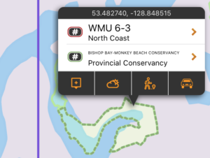
This layer includes the boundaries (and in some cases addition information about) Provincial Parks, Protected Areas, Recreation Areas, Conservancy Areas and Wildlife Management Areas. Specific rules for both access and hunting may exist, and are described in the Wildlife Act (hunting synopsis) or Ministry of Environment webpages. When possible, links are provided for the areas to read more.
They are shown in pale green on the map, and are built into the app as part of the subscription. They can be used even without cell coverage. Tapping on the area will give the park name and some other details.
Recreation Sites and Trails
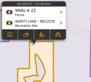
This layer includes the boundaries of Recreation Sites, Recreation Trails, and Interpretative Forests. These land types allow public access, but may have developed amenities and/or access fees for some activities. View the details of each site by tapping on them to read more details about site rules and restrictions. Internet is required to view details.
They are shown in yellow on the map, and are built into the app as part of the subscription. The boundary is visible even without cell coverage, however the details on each site requires internet access.
Manitoba Public Lands Subscription
The Manitoba Public Lands subscription includes 8 different map layers: Public Lands Subscription which includes 8 different layers: Huntable Public Parks, Hunting Restricted Lands, Provincial Forest, Community Pastures, Public Shooting Grounds, Private Conservation Lands, Property Boundaries and the Northern Theoretical Grid.
To use these layers on your map, first make sure you have iHunter MB:
Then either try it free for 3 days or subscribe for only $14.99 per year to benefit from the layers being updated annually.
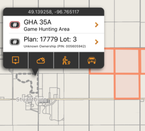
Property Boundaries
Knowing the size and shape of a piece of land makes it easier to discuss with landowners, and being more informed could help with obtaining permission. This layer shows the cadastral boundaries and legal land description information (which can be used to pull land titles). Properties can be tapped on to display the property’s PIN, Acreage, Legal Description, and more. Tapping for more info does require internet access.
These boundaries are shown in grey on the map and downloaded ‘on the fly’ as you view that portion of the map. An Internet connection is required the first time that area and zoom level is viewed. You can pre-cache regions of this layer by using the Manage Cache button (Add Region to Cache).
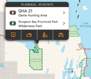
Huntable Public Parks
This layer includes the boundaries (and additional information about) Wilderness Parks, Indigenous Traditional Use Parks, Park Reserves, and Natural Parks that allow hunting. Specific rules for both access and hunting may exist. When possible, links to additional content are provided for the specific areas.
These areas are shown in green on the map, and are built into the app. They can be used even without cell coverage.
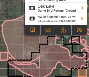
Hunting Restricted Lands
Some land designations forbid hunting by definition. Those area designations included in this layer include some Provincial Parks, Ecological Reserves, National Parks, Wildlife Refuges, Game Bird Refuge, Goose Refuges, Furbearing Animal Refuges, Natural Parks, and Nature Manitoba lands.
This is not a complete listing of every parcel of land the dis-allows hunting, as that is an impossible task. It is merely a visualization of the defined hunting restricted areas as listed above. No-hunting zones described in the Hunting and Trapping Regulations, which do not have digital boundaries published by the province, are not included in this layer.
These areas are shown in red on the map, and are built into the app. They can be used even without cell coverage.
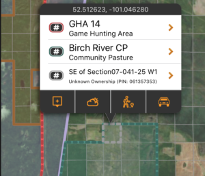
Community Pastures
This layer shows the boundary of the Manitoba Community Pastures. Hunting on community pastures is permitted at times, according to specific conditions (which are listed within iHunter).
These areas shown in teal on the map, and are built into the app. They can be used even without cell coverage.
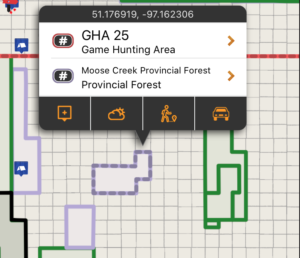
Provincial Forest
This layer shows the boundary of the Manitoba Provincial Forests. Most areas of the Provincial Forest allow hunting and recreational access.
These areas shown in purple on the map, and are built into the app. They can be used even without cell coverage.
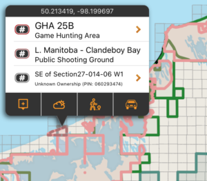
Public Shooting Grounds
Public Shooting grounds are crown lands, established almost a hundred years ago, and provide hunting opportunities for all hunters.
These areas shown in pink on the map, and are built into the app. They can be used even without cell coverage.
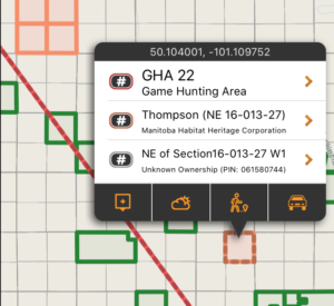
Private Conservation Lands
Many parcels of private land are owned by Conservation organizations such as Ducks Unlimited Canada, Manitoba Habitat Heritage Corporation, Nature Manitoba and Nature Conservancy of Canada. This layer maps and lists these properties with instructions on how to contact them for inquiries.
Public access varies from organization to organization, and the user is responsible for determining access by contacting the conservation organization.
These areas shown in orange on the map, and are built into the app. They can be used even without cell coverage.
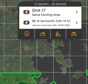
Northern Theoretical Grid
Northern Manitoba is primarily Crown Land that has not been surveyed and parcelled out like the rest of the rest of the province. It can still be helpful to think of the area split into Quarter Sections and Sections, so the Northern Theoretical Grid layer splits the Northern Area into Quarter section parcels, addressable like the rest of the province’s reference grid.
These boundaries are shown in grey on the map and downloaded ‘on the fly’ as you view that portion of the map. An Internet connection is required the first time that area and zoom level is viewed. You can pre-cache regions of this layer by using the Manage Cache button (Add Region to Cache).
Manitoba RM Landowner Maps

Select your RM
Manitoba is split up into about 100 rural municipalities, many of which produce RM landowner maps to show who owns which parcels of land. Open the Map Layers panel in the bottom left corner of the map, and scroll to the Landowner Maps section. Tap on the map you are interested in to view more details.

Confirm boundaries and purchase
Turn on the switch for Show Boundary and then tap Zoom to boundary to make sure that the boundary of the RM landowner map is one that you are interested in. You can also tap within the bounds of an RM and the boundary will be visible.
Landowner maps are sold on an RM by RM basis (not by GHA) and purchases work just like a paper map – you get the version you purchased for as long as you want to use it. Once a new landowner map is available, you can purchase that to get the latest information.
Available maps
- RM of Alonsa (2023)
- RM of Argyle (2023)
- RM of Armstrong (2024)
- Municipality of Boissevain-Morton (2021)
- Municipality of Brenda-Waskada (2023)
- RM of Brokenhead (2018)
- RM of Cartier (2019)
- Cartwright-Roblin Municipality (2024)
- Municipality of Clanwilliam-Erickson (2021)
- RM of Coldwell (2023)
- RM of Cornwallis (2021)
- RM of Dauphin (2022)
- RM of De Salaberry (2021)
- Municipality of Deloraine-Winchester (2022)
- RM of Dufferin (2024)
- RM of Ellice-Archie (2024)
- RM of Elton (2023)
- Municipality of Emerson-Franklin (2016)
- Municipality of Ethelbert (2023)
- RM of Fisher (2024)
- RM of Gilbert Plains (2024)
- RM of Gimli (2022)
- Municipality of Glenboro-South Cypress (2024)
- Municipality of Glenella-Lansdowne (2024)
- Grandview Municipality (2022)
- Municipality of Grassland (2020)
- RM of Grey (2023)
- Hamiota Municipality (2025)
- RM of Hanover (2024)
- Municipality of Harrison Park (2023)
- RM of Kelsey (2023)
- Municipality of Killarney-Turtle Mountain (2024)
- RM of La Broquerie (2022)
- RM of Lakeshore (2021)
- Municipality of Lorne (2024)
- Municipality of Louise (2023)
- RM of Macdonald (2024)
- Municipality of Mccreary (2022)
- Municipality of Minitonas-Bowsman (2023)
- RM of Minto-Odanah (2024)
- RM of Montcalm (2024)
- RM of Morris (2022)
- Mossey River Municipality (2020)
- RM of Mountain (2021)
- Municipality of Norfolk Treherne (2024)
- Municipality of North Cypress-Langford (2024)
- Municipality of North Norfolk (2024)
- Municipality of Oakland-Wawanesa (2024)
- RM of Oakview (2024)
- Municipality of Pembina (2024)
- RM of Piney (2022)
- RM of Pipestone (2023)
- RM of Portage La Prairie (2020)
- RM of Prairie Lakes (2024)
- Prairie View Municipality (2024)
- RM of Reynolds (2023)
- Municipality of Rhineland (2018)
- RM of Riding Mountain West (2024)
- Riverdale Municipality (2022)
- Minicipality of Roblin (2024)
- RM of Roland (2021)
- RM of Rosedale (2024)
- Rossburn Municipality (2024)
- RM of Rosser (2022)
- Municipality of Russell-Binscarth (2020)
- Municipality of Souris-Glenwood (2023)
- RM of St. Francois Xavier (2023)
- RM of St. Laurent (2020)
- RM of Stanley (2024)
- RM of Ste. Anne (2023)
- Municipality of Ste. Rose (2022)
- RM of Stuartburn (2024)
- Municipality of Swan Valley West (2024)
- RM of Thompson (2024)
- Municipality of Two Borders (2023)
- RM of Victoria (2024)
- RM of Wallace-Woodworth (2016)
- RM of West Interlake (2024)
- Municipality of Westlake-Gladstone (2022)
- RM of Whitehead (2019)
- RM of Woodlands (2023)
- RM of Yellowhead (2025)
New Brunswick Public Lands Subscription
The New Brunswick Public Lands subscription includes 6 different map layers: General Use Crown Land, Private Land, Huntable Public Parks, Conservation Lands, and Deer Wintering Areas.
To use these layers on your map, first make sure you have iHunter NB:
Then either try it free for 3 days or subscribe for only $9.99 per year to benefit from the layers being updated annually.
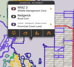
General Use Crown Land
In New Brunswick, 50% of the land base is Crown Land, which is held in public trust by the province for the benefit of the public. The vast majority of this land is publicly accessible.
There may be additional access restrictions on this land that are not documented in openly available GIS layers, and it is the user’s responsibility to obey all posted restrictions in the field. Although we have done our best to ensure this is accurate, discrepancies may exist.
These boundaries are shown in pale purple on the map, and are built into the app. They can be used even without cell coverage. Tapping on the area will give additional information about the selected land (including who owns the Timber License for the area.
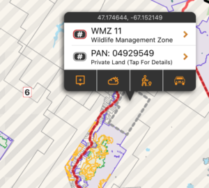
Private Land
Making up the other 50% of land in New Brunswick, private land is important because permission may be required to access it (when posted with Yellow Dots). Knowing the size and shape of a piece of land makes it easier to discuss with a landowner, and being more informed could help with obtaining permission.
These areas are shown with a grey border and a semi transparent striped fill on the map. Each time a new area of the map is viewed, or a new zoom level is looked at, that portion of the layer needs to be downloaded (requiring cell or Wifi service). Once downloaded, those tiles are cached on device for future offline use. You can tap on a parcel of land to retrieve the PAN (Property Account Number), and tap for details to see the Property Assessment information (requires cell or Wifi service).
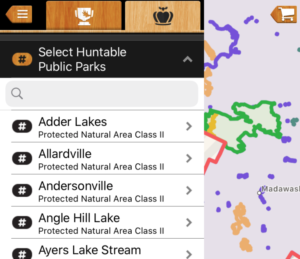
Huntable Public Parks
This layer includes the boundaries (and additional information about) Wildlife Management Areas, Class II Protected Natural Areas, and Military Bases that allow hunting. Specific rules for both access and hunting may exist. When possible, links to additional content are provided for the specific areas.
These boundaries are shown in pale green on the map, and are built into the app. They can be used even without cell coverage. Tapping on the area will give additional information about the selected conservation land.
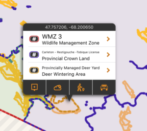
Deer Wintering Areas
As snow accumulates, deer congregate in wintering areas, commonly known as ‘deer yards’. These areas are usually located in mature softwood stands. They provide protection from the blustery winds, intercept snowfall, and minimize the animal’s heat loss.
These areas are shown in orange on the map, and are built into the app. They can be used even without cell coverage. Tapping on the area will link to some additional information from the province about Deer Wintering Areas.
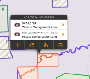
Private Conservation Lands
This layer includes the parcels of private land that are owned by conservation organizations such as Ducks Unlimited, Nature Conservancy of Canada, Canadian Wildlife Service, and The Nature Trust of NB. This layer maps and lists some of these private conservation lands that participate in the Eastern Habitat Joint Venture Partnership (EHJV).
These areas are shown in pale orange on the map, and are built into the app. They can be used even without cell coverage. Tapping on the area doesn’t provide additional information, but does remind you that permission is required.
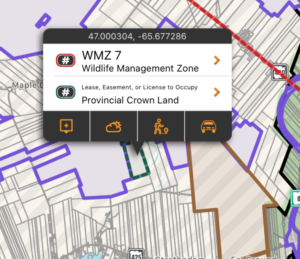
Leases, Easements & Licenses of Occupation
This layer includes the boundaries active commitments on Crown land, including Leases, Easements, and Licenses of Occupation. Note that not all Leases, Easements or Licenses to Occupation have exclusive use of crown land. Consult on-site signage or contact the Department of Energy and Resource Development to inquire about access.
These areas are shown in teal on the map, and are built into the app. They can be used even without cell coverage. Tapping on the area doesn’t provide additional information, but does remind you that permission is required.
Nova Scotia Public Lands Subscription
The Nova Scotia Public Lands subscription includes 6 different map layers: Provincial Crown Land, Private Lands, Huntable Public Parks, Hunting Restricted Public Lands, Private Conservation Lands and Municipal Boundaries.
To use these layers on your map, first make sure you have iHunter NS:
Then either try it free for 3 days or subscribe for only $9.99 per year to benefit from the layers being updated annually.
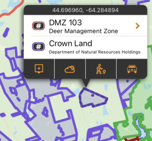
Provincial Crown Land
In Nova Scotia, 29% of the land base is Crown Land, which is held in public trust by the province for the benefit of the public. The vast majority of this land is publicly accessible (for hunting and other purposes). There may be additional access and activity restrictions on this land that are not documented in openly available GIS layers, and it is the user’s responsibility to verify permitted activities and obey all posted restrictions in the field.
These areas are shown in purple on the map, and are built into the app. They can be used even without cell coverage.
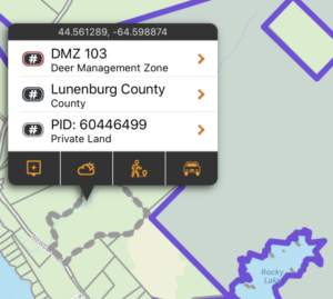
Private Land
71% of land in Nova Scotia is owned privately. Although public access to forest and unmaintained private lands is permitted, having permission to access property for the purposes of hunting is strongly advised. Knowing the size and shape of a piece of land makes it easier to discuss with a landowner, and being more informed could help with obtaining permission.
These boundaries are downloaded ‘on the fly’ as you view that portion of the map. An Internet connection is required the first time that area and zoom level is viewed. You can pre-cache regions of this layer by using the Manage Cache button (Add Region to Cache). These areas can also be tapped on to display the PID number and acreage of the property. Tapping for more info does require internet access.
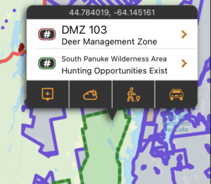
Huntable Public Parks
This layer includes the boundaries (and additional information about) Wilderness Areas, Wildlife Management Areas, and National Wildlife Areas that allow hunting. Specific rules for both access and hunting may exist. When possible, links to additional content are provided for the specific areas.
These areas are shown in green on the map, and are built into the app. They can be used even without cell coverage.
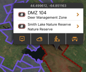
Hunting Restricted Lands
Some land designations forbid hunting entirely or only offer very rare hunting opportunities. Those areas included in this layer include some Game Sanctuaries, Migratory Bird Sanctuaries, Wildlife Management Areas, National Wildlife Areas, National Parks, Military Reserves, Provincial Parks and Nature Reserves.
This is not a complete listing of every parcel of land the dis-allows hunting, as that is an impossible task. It is merely a visualization of the defined hunting restricted areas as listed above. No-hunting zones described in the Hunting and Trapping Regulations, which do not have digital boundaries published by the province, are NOT included in this layer.
These areas are shown in dark red on the map, and are built into the app. They can be used even without cell coverage.
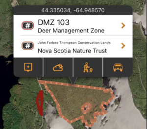
Private Conservation Lands
Many parcels of private land are owned by Conservation organizations such as Nature Conservancy of Canada, Nova Scotia Nature Trust, and other conservancies. This layer maps and lists these private conservation lands in a searchable manner, and provides links to the organizations that own those lands.
Public access varies from organization to organization, and the user is responsible for determining access using the links provided.
These areas shown in orange on the map, and are built into the app. They can be used even without cell coverage.
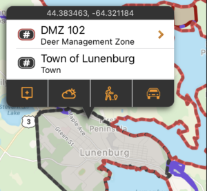
Municipalities
Municipalities have the authority to enforce shooting and hunting restrictions within their jurisdictions. By having these boundaries mapped, you can assess whether you are within the municipal boundary and subject to its bylaws.
These areas shown in dark grey on the map, and are built into the app. They can be used even without cell coverage.
Ontario Public Lands Subscription
The Ontario Public Lands subscription includes 11 different map layers: General Use Crown Land, Private Land, Huntable Public Parks, Hunting Restricted Public Land, Enhanced Management Areas, Licenses of Occupation, Federal Lands, Mining Land Tenure, Patent Crown Land, Municipalities, and MNRF Road Segments.
To use these layers on your map, first make sure you have iHunter ON:
Then either try it free for 3 days or subscribe for only $39.99 per year to benefit from the layers being updated annually.
map layer
General Use Crown Land
87% of Ontario is made up of public land, and the vast majority of this land is publicly accessible. By taking the General Use Public Land boundaries of Ontario and subtracting out the boundaries of all private land, parks, protected areas, reserves and other federal land, we derived the ‘General Use Crown Land layer’.
There may be additional access restrictions on this land that are not documented in openly available GIS layers, and it is the user’s responsibility to obey all posted restrictions in the field. Although we have done our best to ensure this is accurate, discrepancies may exist. This layer should be used as a guideline only.
These boundaries are shown in pale purple on the map, and are built into the app as part of the subscription. They can be used even without cell coverage. Tapping on the area will give additional information about the selected land.
map layer
Private Land
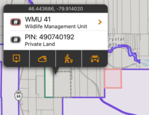
Although making up only 13% of land in Ontario, private land is important because permission is required to access it. Knowing the size and shape of a piece of land makes it easier to discuss with a landowner, and being more informed could help with obtaining permission.
These areas are shown in a grey border with a semi-transparent white filling the areas on the map. Each time a new area of the map is viewed, or a new zoom level is looked at, that portion of the layer needs to be downloaded (requiring cell or Wifi service). Once downloaded, those tiles are cached on device for future offline use.
The private property boundaries in Toronto, Markham, Vaughn, Brampton and Mississauga are not included in this layer.
map layer
Huntable Public Parks
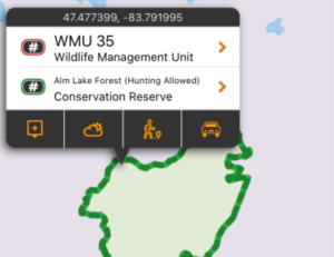
This layer includes the boundaries (and additional information about) Provincial Parks, Wilderness Areas, Conservation Reserves, Forest Reserves, and Far North Protected Areas that allow hunting. Specific rules for both access and hunting may exist. When possible, links to additional content are provided for the specific areas.
These boundaries are shown in pale green on the map, and are built into the app as part of the subscription. They can be used even without cell coverage. Tapping on the area will give additional information about the selected conservation land.
map layer
Municipalities
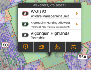
Municipalities have the authority to enforce shooting and hunting restrictions within their jurisdictions. By having these boundaries mapped, you can assess whether you are within the municipal boundary and subject to its bylaws.
They are shown in dark grey on the map, and are built into the app as part of the subscription. They can be used even without cell coverage. Tapping on the area will give municipality name and type.
map layer
Hunting Restricted Public Land
Some land designations forbid hunting by definition. Those area designations included in this layer include some Provincial Parks, Crown Game Preserves, National Parks, National Wildlife Areas, Migratory Bird Sanctuaries, and Other Federal Protected Areas.
This is not a complete listing of every parcel of land the dis-allows hunting, as that is an impossible task. It is merely a visualization of the defined hunting restricted areas as listed above. No-hunting zones described in the Hunting and Trapping Regulations, which do not have digital boundaries published by the province, are NOT included in this layer.
They are shown in pale red on the map, and are built into the app as part of the subscription. They can be used even without cell coverage. Tapping on the area will give the Park name and designation.
map layer
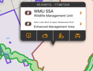
Enhanced Management Areas
Enhanced Management Areas is a land use category that has been established in order to provide more detailed land use direction in areas of special features or values. A wide variety of resource and recreational users can occur in EMAs. In some areas, specific uses may be subject to conditions that are designed to support the values that make the area special. Enhanced Management Areas may lead to modifications (e.g., timing, location, method, access) in resource-management practices in order to recognize other land use values. In the detailed view of each EMA, you can see whether public access to roads, hunting, fishing, and other activities is permitted
They are shown in orange on the map, and are built into the app and can be used even without cell coverage, however the detailed view of each EMA requires cell coverage or wifi.
map layer
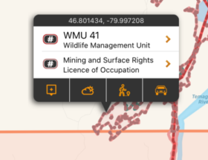
Licenses of Occupation
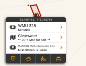
Thousands of parcels of Public Land in Ontario are subject to Licenses of Occupation (LOC). An LOC gives the licensee certain rights and responsibilities, such as:
- gives the right to use the land for up to 20 years, but does not give ownership of the land
- no extensive and/or valuable improvements to the land can be made
- no future financial or environmental liability is anticipated as a result of the intended land use
- rights granted are transferable, with ministry consent, but there is no right of renewal
In most cases, these LOCs do not prevent other valid land uses. However, we map these regions as there may be other non-recreational activities taking place. Additional care should be taken if accessing one of these areas, and all signage should be obeyed.
They are shown in pale pink on the map, and are built into the app as part of the subscription. They can be used even without cell coverage. Tapping on the area will give the disposition number, tenure number, or OGF ID.
map layer
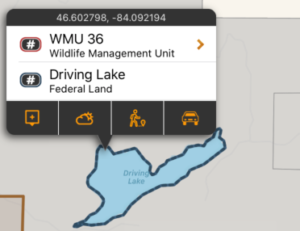
Federal Lands
The Federal Lands layer includes Military Bases, Airports, Weather Radar Sites, First Nations Settlements, and Dams. These lands are not publicly accessible for hunting.
This is not a complete listing of every parcel of Federal Land, but is the most accurate data available publicly. Some small island parcels are not included in this layer due to size and performance constraints.
They are shown in navy on the map, and are built into the app as part of the subscription. They can be used even without cell coverage. Tapping on the area will give the land name and type.
map layer
Mining Land Tenure
The Mining Land Tenure layer includes surface and mining rights on private or crown land. Surface and mining rights on private or crown land mean that the land is not available for public access. Permissions is required from the leaseholder or private landowner.
They are shown in yellow on the map, and are built into the app. They can be used even without cell coverage.
map layer
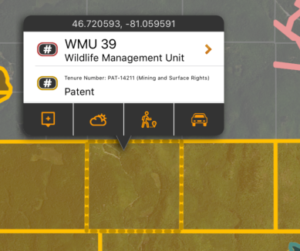
Patent Crown Land
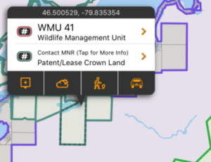
The Patent Crown Land layer consists of parcels of crown land with uncertain access restrictions. These parcels may be used by the province, leased out for exclusive use to third parties, or possibly available for public access.
There may be access restrictions on these land parcels that are not documented in openly available data, and it is the user’s responsibility to obey all posted restrictions in the field. Discrepancies may exist and this layer should be used as a guideline only. You should not assume public access without verifying with the MNR.
They are shown in teal on the map, and are built into the app. They can be used even without cell coverage.
map layer
MNRF Road Segments
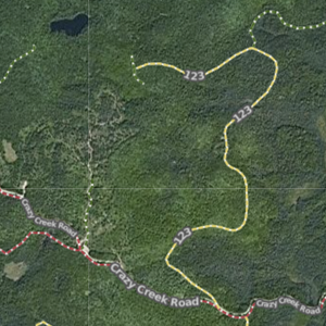
The Ministry of Natural Resources and Forestry Road Segments layer contains MNRF roads that are the linear geometry of the road. It consists of roads that have actually existed as a path supporting conventional four-wheel street legal vehicles. Specifically not to be included are paths constructed for off-road vehicles (e.g. ATV trail) and temporary paths related to forest management (e.g. skidder trail) or forest fire management (e.g. rehabilitated fire trail).
The roads are shown as dashed lines on the map and coloured to indicate their status:
Green indicates open roads.
Yellow indicates restricted roads.
Red indicates closed roads.
Each time a new area of the map is viewed, or a new zoom level is looked at, that portion of the layer needs to be downloaded (requiring cell or Wifi service). Once downloaded, those tiles are cached on device for future offline use.
Quebec Public Lands Subscription
The Quebec Public Lands subscription includes 7 different map layers: Provincial Crown Land, Private Land, Park, Outfitter, Municipality, Regional County Municipality, and Trail boundaries.
To use these layers on your map, first make sure you have iHunter QC:
Then either try it free for 3 days or subscribe for only $9.99 per year to benefit from the layers being updated annually.
Provincial Crown Land
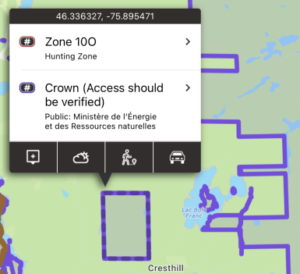
92% of Quebec is made up of public land, and the vast majority of this land is publicly accessible. There may be additional access and discharge restrictions on this land that are not documented in openly available GIS layers, and it is the user’s responsibility to obey all posted restrictions in the field. The cartographic representation of the private or public nature of land and authority is constructed from archived data from the old Terrier register (SITAT), requests for transfers of authority, state property transactions and the integration of data from the cadastre of Quebec. On the other hand, this representation does not take into account certain reservations established by law (three chains, borders, paths, beds of watercourses, etc.). Consequently, this representation has no legal value, and it is always necessary to refer to the deeds or to the letters patent and to apply the law in order to determine the ownership of a portion of the territory.
These areas are shown in purple on the map, and are built into the app. They can be used even without cell coverage.
Private Land
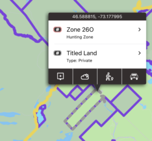
Although making up only 8% of land in Quebec, private land is important because permission is required to access it.
These boundaries are downloaded ‘on the fly’ as you view that portion of the map. An Internet connection is required the first time that area and zoom level is viewed. You can pre-cache regions of this layer by using the Manage Cache button (Add Region to Cache). These areas can also be tapped on to display additional information including the acreage of the property. Tapping for more info does require internet access.

Parks
The Parks layer includes the boundaries for National Parks, Provincial Parks, and Regional Parks. Hunting is not permitted in any Québec park, however fishing may be permitted.
These areas are shown in dark red on the map, and are built into the app. They can be used even without cell coverage.
Outfitters
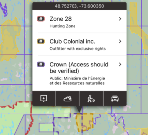
Outfitters with exclusive rights are outfitters that have exclusive wildlife exploitation rights in a given territory, under an exclusive rights lease arrangement with the Ministry, for hunting and/or fishing and/or trapping. The designated territory is subject to a specific Wildlife Trust agreement and only the outfitter’s clients are permitted to hunt, fish or trap within that territory. The representation of this territory has no legal claim. Only filed documents have the force of law.
These areas are shown in dark yellow on the map, and are built into the app. They can be used even without cell coverage.
Municipalities
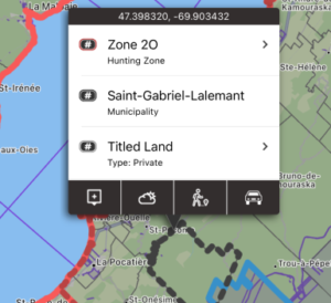
Municipalities have the authority to enforce shooting and hunting restrictions within their jurisdictions. By having these boundaries mapped, you can assess whether you are within the municipal boundary and subject to its bylaws.
These areas shown in dark grey on the map, and are built into the app. They can be used even without cell coverage.
Regional County Municipalities
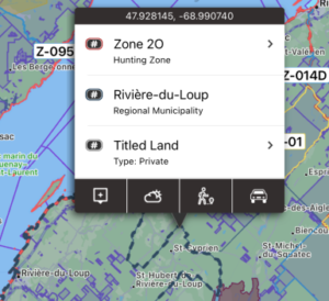
Regional County Municipalities are for information purposes only and shouldn’t have any effect on hunting seasons or rules.
These areas shown in navy on the map, and are built into the app. They can be used even without cell coverage.
Trails
The Trails layer includes a compilation of trail networks including: Snowmobile trails (CUGR), Snowmobile trails (FCMQ), Snowmobile trails (White Route), Quad bike trails (CUGR), Quad bike trails (FQCQ), Hiking trails, and Archery trails.
These trails are shown as light grey dotted lines on the map. These boundaries are downloaded ‘on the fly’ as you view that portion of the map. An Internet connection is required the first time that area and zoom level is viewed. You can pre-cache regions of this layer by using the Manage Cache button (Add Region to Cache).
Saskatchewan Public Lands Subscription
The Saskatchewan Public Lands subscription includes 5 different map layers: Provincial Forest, Fish and Wildlife Development Fund Land, Huntable Public Parks, No-Hunting areas, and Municipalities.
To use these layers on your map, first make sure you have iHunter SK:
Then either try it free for 3 days or subscribe to the Saskatchewan Public Land layers for only $9.99 per year so you’re always up to date.
map layer
Provincial Forest
This layer shows approximate boundary of the Saskatchewan Provincial Forest. Most areas of the Provincial Forest allow hunting and recreational access.
Be aware that there are pockets of private land, provincial parks, agricultural lease land, reservations, and other land types that may prevent access. Always use other sources of information such as on-site signage, fencing and other maps to make decisions on access. Use this boundary as a guideline only, as the Province is currently updating this boundary to be more accurate.
These boundaries are shown in pale purple on the map, and are built into the app as part of the subscription. They can be used even without cell coverage. Tapping on the area will give additional information about the selected land.
map layer
Fish & Wildlife Development Fund Lands
Wildlife lands are not reserves or sanctuaries. These natural areas have been bought with your hunting and trapping dollars, and can be used by everyone. Naturally, hunting is allowed on these lands. Lands are also open to other outdoor nature enthusiasts, including hikers, bird watchers and photographers.
There are four main rules when visiting FWDF lands:
- Walk-in traffic only (except when retrieving big game during hunting season)
- Walk-in camping only – no open fires;
- No littering;
- and No interference with an authorized management treatment (e.g., haying or grazing).
These boundaries are shown in orange on the map, and are built into the app as part of the subscription. They can be used even without cell coverage. Tapping on the area will give additional information about the selected land.
map layer
Huntable Public Parks
The Huntable Public Parks layer is made up of three types of public land that are all accessible and allow hunting: National Wildlife Areas, some Provincial Parks, and some Recreation Sites. Some areas have special restrictions such as firearms limitations or restricted areas, restricted hunting seasons, etc. In general, they all allow hunting in some form.
These boundaries are shown in pale green on the map, and are built into the app as part of the subscription. They can be used even without cell coverage. Tapping on the area will give additional information about the selected land.
map layer
Municipalities
Municipalities have the authority to enforce shooting and hunting restrictions within their jurisdictions. By having these boundaries mapped, you can assess whether you are within the municipal boundary and subject to its bylaws.
They are shown in dark grey on the map, and are built into the app as part of the subscription. They can be used even without cell coverage. Tapping on the area will give municipality name and type.
map layer
No Hunting Areas
Some land designations forbid hunting by definition. Those area designations included in this layer include Ecological Reserves, National Parks, Migratory Bird Sanctuaries, Game Preserves, Wildlife Refuges, and some Provincial Parks and Recreation Sites.
This is not a complete listing of every parcel of land the dis-allows hunting, as that is an impossible task. It is merely a visualization of the defined no hunting zones as listed above. No-hunting zones described in the Hunting and Trapping Regulations, which do not have digital boundaries published by the province, are NOT included in this layer.
They are shown in black on the map, and are built into the app as part of the subscription. They can be used even without cell coverage. Tapping on the area will give the Park name and designation.
Saskatchewan RM Landowner Maps
iHunter Saskatchewan offers county landowner maps for sale within the app.
To use these layers on your map, first make sure you have iHunter SK:
Then add individual maps for between $14.99 and $21.99 depending on the county.*
* For a limited time you can save $2 by purchasing the map while using the iHunter Web app.

Select your RM
Saskatchewan is split up into nearly 300 rural municipalities, which each produce their own RM landowner maps to show who owns which parcels of land. Over 90% of the counties have been integrated and we are continuously working on getting more. Open the Map Layers panel in the bottom left corner of the map, and scroll to the Landowner Maps section. Tap on the map you are interested in to view more details.

Confirm boundaries and purchase
Turn on the switch for Show Boundary and then tap Zoom to boundary to make sure that the boundary of the RM landowner map is one that you are interested in. You can also tap within the bounds of a county and the boundary will be shown on the map (blue, dashed line).
Landowner maps are sold on an RM by RM basis (not by WMZ) and purchases work just like a paper map – you get the version you purchased for as long as you want to use it. Once a new landowner map is available, you can purchase that to get the latest information.
Available maps
- RM of Aberdeen No. 373 (2024)
- RM of Abernethy No. 186 (2025)
- RM of Antelope Park No. 322 (2024)
- RM of Antler No. 061 (2019)
- RM of Arborfield No. 456 (2020)
- RM of Argyle No. 001 (2024)
- RM of Arlington No. 079 (2023)
- RM of Arm River No. 252 (2023)
- RM of Auvergne No. 076 (2021)
- RM of Baildon No. 131 (2022)
- RM of Barrier Valley No. 397 (2024)
- RM of Battle River No. 438 (2024)
- RM of Bayne No. 371 (2024)
- RM of Beaver River No. 622 (2023)
- RM of Bengough No. 040 (2021)
- RM of Benson No. 035 (2024)
- RM of Biggar No. 347 (2024)
- RM of Big Stick No. 141 (2024)
- RM of Big Arm No. 251 (2021)
- RM of Big Quill No. 308 (2024)
- RM of Birch Hills No. 460 (2024)
- RM of Blaine Lake No. 434 (2022)
- RM of Blucher No. 343 (2022)
- RM of Bone Creek No. 108 (2024)
- RM of Bratt’s Lake No. 129 (2022)
- RM of Brock No. 064 (2022)
- RM of Brokenshell No. 068 (2024)
- RM of Browning No. 034 (2024)
- RM of Buchanan No. 304 (2024)
- RM of Buckland No. 491 (2023)
- RM of Buffalo No. 409 (2024)
- RM of Calder No. 241 (2024)
- RM of Caledonia No. 099 (2019)
- RM of Cambria No. 006 (2023)
- RM of Cana No. 214 (2024)
- RM of Canaan No. 225 (2024)
- RM of Canwood No. 494 (2024)
- RM of Carmichael No. 109 (2025)
- RM of Caron No. 162 (2023)
- RM of Chaplin No. 164 (2021)
- RM of Chester No. 125 (2023)
- RM of Chesterfield No. 261 (2024)
- RM of Clayton No. 333 (2022)
- RM of Clinworth No. 230 (2024)
- RM of Coalfields No. 004 (2025)
- RM of Colonsay No. 342 (2024)
- RM of Connaught No. 457 (2024)
- RM of Corman Park No. 344 (2024)
- RM of Cote No. 271 (2023)
- RM of Coteau No. 255 (2022)
- RM of Coulee No. 136 (2020)
- RM of Craik No. 222 (2024)
- RM of Cupar No. 218 (2024)
- RM of Cut Knife No. 439 (2022)
- RM of Cymri No. 036 (2024)
- RM of Deer Forks No. 232 (2018)
- RM of Duck Lake No. 463 (2024)
- RM of Dufferin No. 190 (2024)
- RM of Dundurn No. 314 (2023)
- RM of Eagle Creek No. 376 (2023)
- RM of Edenwold No. 158 (2023)
- RM of Elcapo No. 154 (2021)
- RM of Eldon No. 471 (2022)
- RM of Elfros No. 307 (2024)
- RM of Elmsthorpe No. 100 (2024)
- RM of Emerald No. 277 (2019)
- RM of Enfield No. 194 (2024)
- RM of Enniskillen No. 003 (2024)
- RM of Enterprise No. 142 (2023)
- RM of Estevan No. 005 (2024)
- RM of Excel No. 071 (2019)
- RM of Excelsior No. 166 (2023)
- RM of Eyebrow No. 193 (2024)
- RM of Eye Hill No. 382 (2021)
- RM of Fertile Valley No. 285 (2024)
- RM of Fertile Belt No. 183 (2023)
- RM of Fillmore No. 096 (2024)
- RM of Fish Creek No. 402 (2024)
- RM of Flett’s Springs No. 429 (2024)
- RM of Foam Lake No. 276 (2022)
- RM of Fox Valley No. 171 (2024)
- RM of Francis No. 127 (2022)
- RM of Frenchman Butte No. 501 (2023)
- RM of Frontier No. 019 (2023)
- RM of Garden River No. 490 (2021)
- RM of Garry No. 245 (2024)
- RM of Glenside No. 377 (2024)
- RM of Glen Bain No. 105 (2024)
- RM of Glen McPherson No. 046 (2023)
- RM of Golden West No. 095 (2024)
- RM of Good Lake No. 274 (2019)
- RM of Grandview No. 349 (2024)
- RM of Grant No. 372 (2022)
- RM of Grassy Creek No. 078 (2021)
- RM of Gravelbourg No. 104 (2023)
- RM of Grayson No. 184 (2024)
- RM of Great Bend No. 405 (2024)
- RM of Griffin No. 66 (2021)
- RM of Gull Lake No. 139 (2024)
- RM of Happyland No. 231 (2024)
- RM of Happy Valley No. 10 (2023)
- RM of Harris No. 316 (2024)
- RM of Hart Butte No. 011 (2024)
- RM of Hazel Dell No. 335 (2024)
- RM of Hazelwood No. 094 (2024)
- RM of Heart’s Hill No. 352 (2023)
- RM of Hillsborough No. 132 (2024)
- RM of Hillsdale No. 440 (2024)
- RM of Hudson Bay No. 394 (2024)
- RM of Humboldt No. 370 (2021)
- RM of Huron No. 223 (2024)
- RM of Indian Head No. 156 (2023)
- RM of Insinger No. 275 (2024)
- RM of Invergordon No. 430 (2024)
- RM of Invermay No. 305 (2024)
- RM of Ituna Bon Accord No. 246 (2023)
- RM of Kellross No. 247 (2019)
- RM of Kelvington No. 366 (2024)
- RM of Keys No. 303 (2024)
- RM of Key West No. 070 (2024)
- RM of Kindersley No. 290 (2024)
- RM of King George No. 256 (2024)
- RM of Kingsley No. 124 (2024)
- RM of Kinistino No. 549 (2024)
- RM of Lac Pelletier No. 107 (2021)
- RM of Lacadena No. 228 (2023)
- RM of Laird No. 404 (2019)
- RM of Lajord No. 128 (2023)
- RM of Lake Alma No. 008 (2024)
- RM of Lake Johnston No. 102 (2020)
- RM of Lake Lenore No. 399 (2024)
- RM of Lake of the Rivers No. 072 (2019)
- RM of Lakeside No. 338 (2023)
- RM of Lakeview No. 337 (2024)
- RM of Langenburg No. 181 (2023)
- RM of Last Mountain Valley No. 250 (2024)
- RM of Laurier No. 038 (2024)
- RM of Lawtonia No. 135 (2024)
- RM of Leask No. 464 (2023)
- RM of LeRoy No. 339 (2024)
- RM of Lipton No. 217 (2024)
- RM of Livingston No. 331 (2022)
- RM of Lomond No. 037 (2024)
- RM of Longlaketon No. 219 (2022)
- RM of Loon Lake No. 561 (2023)
- RM of Loreburn No. 254 (2023)
- RM of Lumsden No. 189 (2025)
- RM of Manitou Lake No. 442 (2022)
- RM of Mankota No. 045 (2023)
- RM of Maple Bush No. 224 (2024)
- RM of Maple Creek No. 111 (2023)
- RM of Mariposa No. 350 (2024)
- RM of Marquis No. 191 (2023)
- RM of Marriott No. 317 (2024)
- RM of Martin No. 122 (2022)
- RM of Maryfield No. 091 (2019)
- RM of Mayfield No. 406 (2024)
- RM of McCraney No. 282 (2022)
- RM of McKillop No. 220 (2019)
- RM of McLeod No. 185 (2023)
- RM of Meadow Lake No. 588 (2023)
- RM of Medstead No. 497 (2022)
- RM of Meeting Lake No. 466 (2024)
- RM of Meota No. 468 (2024)
- RM of Milden No. 286 (2024)
- RM of Milton No. 292 (2024)
- RM of Miry Creek No. 229 (2023)
- RM of Monet No. 257 (2022)
- RM of Montmartre No. 126 (2023)
- RM of Montrose No. 315 (2021)
- RM of Moose Creek No. 033 (2023)
- RM of Moose Jaw No. 161 (2022)
- RM of Moose Mountain No. 063 (2023)
- RM of Moosomin No. 121 (2022)
- RM of Morse No. 165 (2023)
- RM of Mount Hope No. 279 (2024)
- RM of Mount Pleasant No. 002 (2024)
- RM of Mountain View No. 318 (2024)
- RM of Newcombe No. 260 (2024)
- RM of Nipawin No. 487 (2024)
- RM of North Battleford No. 437 (2023)
- RM of North Qu’Appelle No. 187 (2021)
- RM of Norton No. 069 (2024)
- RM of Oakdale No. 320 (2024)
- RM of Old Post No. 043 (2023)
- RM of Orkney No. 244 (2024)
- RM of Paddockwood No. 520 (2021)
- RM of Parkdale No. 498 (2019)
- RM of Paynton No. 470 (2024)
- RM of Pense No. 160 (2024)
- RM of Perdue No. 346 (2025)
- RM of Piapot No. 110 (2024)
- RM of Pinto Creek No. 075 (2023)
- RM of Pittville No. 169 (2024)
- RM of Pleasantdale No. 398 (2024)
- RM of Pleasant Valley No. 288 (2024)
- RM of Ponass Lake No. 367 (2019)
- RM of Poplar Valley No. 012 (2024)
- RM of Porcupine No. 395 (2024)
- RM of Prairiedale No. 321 (2024)
- RM of Prairie Rose No. 309 (2024)
- RM of Preeceville No. 334 (2024)
- RM of Prince Albert No. 461 (2024)
- RM of Progress No. 351 (2024)
- RM of Reciprocity No. 032 (2024)
- RM of Redburn No. 130 (2019)
- RM of Reford No. 379 (2024)
- RM of Reno No. 051 (2023)
- RM of Riverside No. 168 (2023)
- RM of Rocanville No. 151 (2020)
- RM of Rodgers No. 133 (2024)
- RM of Rosedale No. 283 (2024)
- RM of Rosemount No. 378 (2021)
- RM of Round Hill No. 467 (2023)
- RM of Round Valley No. 410 (2023)
- RM of Rosthern No. 403 (2025)
- RM of Rudy No. 284 (2024)
- RM of Saltcoats No. 213 (2024)
- RM of Sarnia No. 221 (2024)
- RM of Saskatchewan Landing No. 167 (2024)
- RM of Sasman No. 336 (2019)
- RM of Scott No. 098 (2024)
- RM of Senlac No. 411 (2021)
- RM of Shamrock No. 134 (2024)
- RM of Shellbrook No. 493 (2021)
- RM of Sherwood No. 159 (2023)
- RM of Silverwood No. 123 (2024)
- RM of Sliding Hills No. 273 (2022)
- RM of Snipe Lake No. 259 (2022)
- RM of Souris Valley No. 007 (2024)
- RM of South Qu’Appelle No. 157 (2024)
- RM of Spalding No. 368 (2024)
- RM of Spiritwood No. 496 (2024)
- RM of Spy Hill No. 152 (2021)
- RM of St. Andrews No. 287 (2024)
- RM of St. Louis No. 431 (2024)
- RM of St. Peter No. 369 (2024)
- RM of St. Philips No. 301 (2024)
- RM of Stanley No. 215 (2024)
- RM of Star City No. 428 (2024)
- RM of Stonehenge No. 073 (2024)
- RM of Storthoaks No. 31 (2024)
- RM of Surprise Valley No. 009 (2024)
- RM of Sutton No. 103 (2022)
- RM of Swift Current No. 137 (2024)
- RM of Tecumseh No. 065 (2023)
- RM of Terrell No. 101 (2024)
- RM of The Gap No. 39 (2024)
- RM of The Scott No. 98 (2023)
- RM of Three Lakes No. 400 (2024)
- RM of Tisdale No. 427 (2024)
- RM of Torch River No. 488 (2024)
- RM of Touchwood No. 248 (2024)
- RM of Tramping Lake No. 380 (2024)
- RM of Tullymet No. 216 (2024)
- RM of Turtle River No. 469 (2024)
- RM of Usborne No. 310 (2019)
- RM of Val Marie No. 017 (2023)
- RM of Vanscoy No. 345 (2024)
- RM of Victory No. 226 (2022)
- RM of Viscount No. 341 (2024)
- RM of Wallace No. 243 (2020)
- RM of Walpole No. 092 (2024)
- RM of Waverley No. 044 (2021)
- RM of Wawken No. 093 (2024)
- RM of Webb No. 138 (2022)
- RM of Wellington No. 097 (2024)
- RM of Weyburn No. 067 (2024)
- RM of Wheatlands No. 163 (2024)
- RM of Whiska Creek No. 106 (2024)
- RM of White Valley No. 049 (2023)
- RM of Willner No. 253 (2023)
- RM of Willow Bunch No. 042 (2023)
- RM of Willow Creek No. 458 (2024)
- RM of Willowdale No. 153 (2023)
- RM of Winslow No. 319 (2024)
- RM of Wilton No. 472 (2024)
- RM of Wise Creek No. 077 (2021)
- RM of Wolverine No. 340 (2024)
- RM of Wood Creek No. 281 (2024)
- RM of Wood River No. 074 (2019)
- RM of Wreford No. 280 (2024)
Yukon Public Land Subscription
The Quebec Public Lands subscription includes 11 different map layers: Crown Land, Surveyed Land, Communities, Agricultural Land Dispositions, Outfitter Concessions, Trapping Concessions, Off-road Vehicle Restrictions, Off-road Vehicle Plans, Forestry Roads, Yukon Road Network, and Trails.
To use these layers on your map, first make sure you have iHunter YT:
Then either try it free for 3 days or subscribe for only $9.99 per year to benefit from the layers being updated annually.
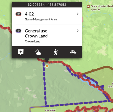
Crown Land
By taking the land boundaries of the Yukon and subtracting out the boundaries of all surveyed land, parks, and reserves, leases, and communities, we derived the ‘Crown Land’ layer. There may be additional access and discharge restrictions on this land that are not documented in openly available GIS layers, and it is the user’s responsibility to obey all posted restrictions in the field. Although we have done our best to ensure this is accurate, discrepancies may exist. This layer should be used as a guideline only.
These areas are shown in purple on the map, and are built into the app. They can be used even without cell coverage.
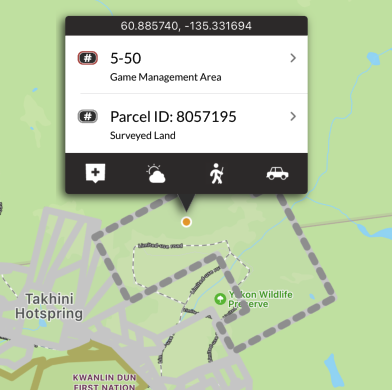
Surveyed Land
Surveyed Land Parcels are real property objects that represent the spatial extent of a lot or parcel of land against which rights and interests may be registered. Land Parcel with a parcel status of ‘Active’ form the current cadastral fabric.
These areas are shown in grey on the map, and are built into the app. They can be used even without cell coverage.
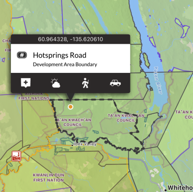
Communities
This layer is made up of several community boundaries including: Municipal, Development Area Regulations, Land Claims Final Agreement, Self Government Agreement, Memorandum of Understanding, Local Area Plans, and Community Plans.
These areas are shown in dark grey on the map, and are built into the app. They can be used even without cell coverage.
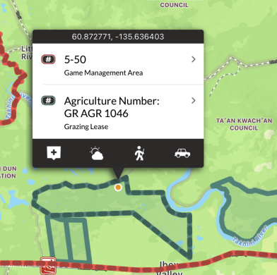
Agricultural Land Dispositions
This layer includes land under administration and control of Government of Yukon, Department of Energy, Mines and Resources (EMR), or Agriculture Branch. It includes all dispositions of agricultural land.
These areas are shown in teal on the map, and are built into the app. They can be used even without cell coverage.
Outfitting Areas
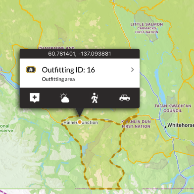
This layer displays outfitting concessions (OCs) which are also known as Outfitting Areas. They are legal boundaries that define an area where the holder of the concession has the exclusive right to outfit non-residents for the purpose of hunting big game animals (excepting special guiding licenses). If a non-resident wishes to hunt in the Yukon they must do so accompanied by a Yukon resident–either a private individual who does this for free, or a commercial operator who does this as a business (an outfitter). Each outfitter is licensed to operate within a particular OA. There are 20 such concessions in the Yukon–one per licensed outfitter. OCs are largely (but not always) defined by groupings of Game Management Areas. There are several areas within the Yukon (exclusive of National Parks) which are not covered by OCs.
These areas are shown in orange on the map, and are built into the app. They can be used even without cell coverage.
Trapping Concessions
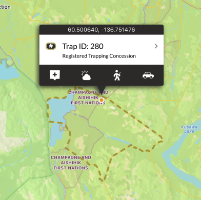
This layer displays registered trapping concessions (RTCs). They are legal boundaries that define an area where the holder of the concession has the exclusive right to trap furbearing animals. Because trapping is done primarily along waterways, RTCs are often defined by watersheds, using height of land (ridges and mountain peaks) as their boundaries. This is the opposite of GMAs which are defined by mountains. Sometimes RTCs are grouped together to form a Group Trapping Concession (in which groups of individual share the right to trap). This may or may not involve the elimination of the component RTC boundaries. The Yukon has 360 RTCs and 13 Group Trapping Concessions. Only Kluane National Park, Kluane Wildlife Sanctuary, and Ddhaw Ghro Habitat Protection are are not covered by RTCs.
These areas are shown in yellow on the map, and are built into the app. They can be used even without cell coverage.
Off-road Vehicle Restrictions
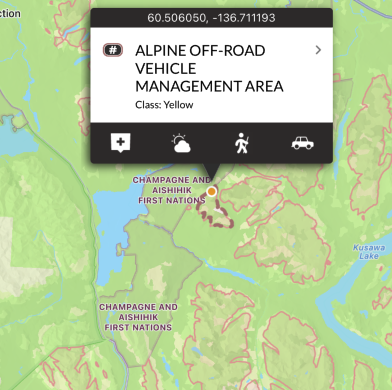
ORV management areas are designate areas where off-road vehicle use is managed for the protection of ecological balance or physical characteristics within the area, including on mineral claims and in territorial parks. Off-road vehicle management areas can result from recommendations coming out of public planning processes, such as regional land-use planning, local area planning and special management areas such as Habitat Protection areas or parks. Governments and other groups, such as the Fish and Wildlife Management Boards and Renewable Resource Councils can submit a proposal that identifies ecologically-sensitive areas that off-road vehicle management areas could protect. This layer should be used in conjunction with the ORV Trail Plans that shows trails found within these boundaries.
These areas are shown in pink on the map, and are built into the app. They can be used even without cell coverage.
Off-road Vehicle Plans
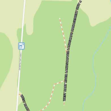
This layer contains dashed line segments representing off road vehicle (ORV) trail plans. It shows the trails within the off-road vehicle management area or part of the off-road vehicle management area for which a trail plan is developed, on which an off-road vehicle may be used. There are labels describing whether an ORV is permitted, prohibited, or prohibited except where designated by an approved Off Road Management Area Trail Plan.
These areas are shown as pink dashed lines on the map, and are not built into the app. Each time a new area of the map is viewed, or a new zoom level is looked at, that portion of the layer needs to be downloaded (requiring cell or Wifi service). Once downloaded, those tiles are cached on device for future offline use.
Forestry Roads
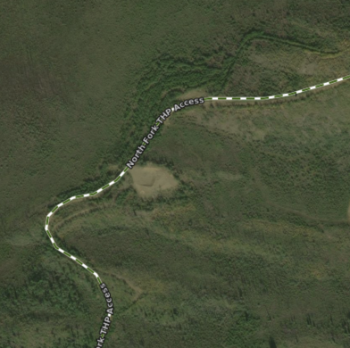
This layer contains road segments that are the linear geometry of the road. It consists of forest resource roads (FRR) that are actively used for accessing forest resources. These roads do not represent a complete road network, they should be viewed in conjunction with the Roads Network layer. Many FRRs are gated with controlled access. There are four categories of roads in the dataset: Forest Resource Roads (act); Forest Resource Access (non-act), Public Access (non-act) and auxiliary roadsroads.
These areas are shown as green dashed lines on the map, and are not built into the app. Each time a new area of the map is viewed, or a new zoom level is looked at, that portion of the layer needs to be downloaded (requiring cell or Wifi service). Once downloaded, those tiles are cached on device for future offline use.
Yukon Road Network
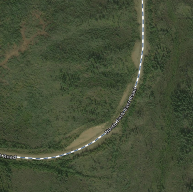
The Yukon Road Network is the authoritative source of road data for Yukon. This dataset represents road centrelines for road features administered by Government of Yukon. Road features not administered by Government of Yukon are supplied by Canvec Road Network.
These areas are shown as navy blue dashed lines on the map, and are not built into the app. Each time a new area of the map is viewed, or a new zoom level is looked at, that portion of the layer needs to be downloaded (requiring cell or Wifi service). Once downloaded, those tiles are cached on device for future offline use.
Trails
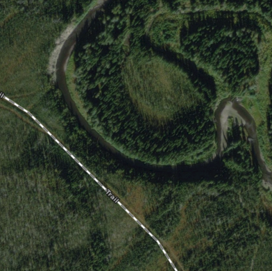
The Yukon Trail network displays transportation features including limited-use roads, cutlines, and trails.
These areas are shown as grey dashed lines on the map, and are not built into the app. Each time a new area of the map is viewed, or a new zoom level is looked at, that portion of the layer needs to be downloaded (requiring cell or Wifi service). Once downloaded, those tiles are cached on device for future offline use.


