New Brunswick Public Lands Subscription
The New Brunswick Public Lands subscription includes 6 different map layers: General Use Crown Land, Private Land, Huntable Public Parks, Conservation Lands, and Deer Wintering Areas.
To use these layers on your map, first make sure you have iHunter NB:
Then either try it free for 3 days or subscribe for only $9.99 per year to benefit from the layers being updated annually.
General Use Crown Land
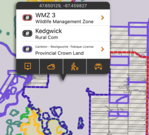
In New Brunswick, 50% of the land base is Crown Land, which is held in public trust by the province for the benefit of the public. The vast majority of this land is publicly accessible.
There may be additional access restrictions on this land that are not documented in openly available GIS layers, and it is the user’s responsibility to obey all posted restrictions in the field. Although we have done our best to ensure this is accurate, discrepancies may exist.
These boundaries are shown in pale purple on the map, and are built into the app. They can be used even without cell coverage. Tapping on the area will give additional information about the selected land (including who owns the Timber License for the area.
Private Land
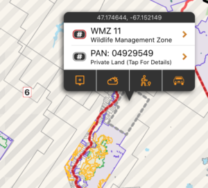
Making up the other 50% of land in New Brunswick, private land is important because permission may be required to access it (when posted with Yellow Dots). Knowing the size and shape of a piece of land makes it easier to discuss with a landowner, and being more informed could help with obtaining permission.
These areas are shown with a grey border and a semi transparent striped fill on the map. Each time a new area of the map is viewed, or a new zoom level is looked at, that portion of the layer needs to be downloaded (requiring cell or Wifi service). Once downloaded, those tiles are cached on device for future offline use. You can tap on a parcel of land to retrieve the PAN (Property Account Number), and tap for details to see the Property Assessment information (requires cell or Wifi service).
Huntable Public Parks
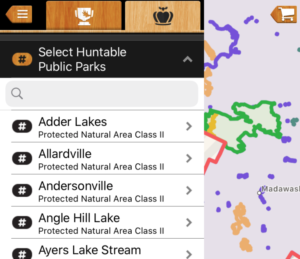
This layer includes the boundaries (and additional information about) Wildlife Management Areas, Class II Protected Natural Areas, and Military Bases that allow hunting. Specific rules for both access and hunting may exist. When possible, links to additional content are provided for the specific areas.
These boundaries are shown in pale green on the map, and are built into the app. They can be used even without cell coverage. Tapping on the area will give additional information about the selected conservation land.
Deer Wintering Areas
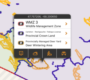
As snow accumulates, deer congregate in wintering areas, commonly known as ‘deer yards’. These areas are usually located in mature softwood stands. They provide protection from the blustery winds, intercept snowfall, and minimize the animal’s heat loss.
These areas are shown in orange on the map, and are built into the app. They can be used even without cell coverage. Tapping on the area will link to some additional information from the province about Deer Wintering Areas.
Private Conservation Lands
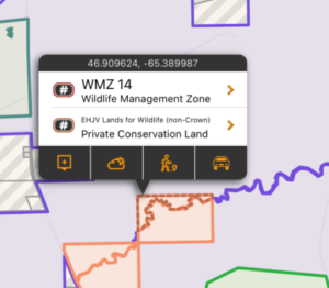
This layer includes the parcels of private land that are owned by conservation organizations such as Ducks Unlimited, Nature Conservancy of Canada, Canadian Wildlife Service, and The Nature Trust of NB. This layer maps and lists some of these private conservation lands that participate in the Eastern Habitat Joint Venture Partnership (EHJV).
These areas are shown in pale orange on the map, and are built into the app. They can be used even without cell coverage. Tapping on the area doesn’t provide additional information, but does remind you that permission is required.
Leases, Easements & Licenses of Occupation
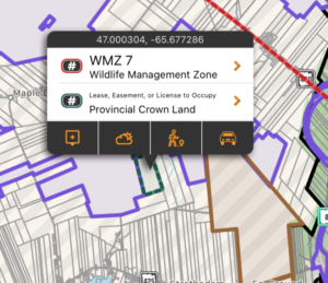
This layer includes the boundaries active commitments on Crown land, including Leases, Easements, and Licenses of Occupation. Note that not all Leases, Easements or Licenses to Occupation have exclusive use of crown land. Consult on-site signage or contact the Department of Energy and Resource Development to inquire about access.
These areas are shown in teal on the map, and are built into the app. They can be used even without cell coverage. Tapping on the area doesn’t provide additional information, but does remind you that permission is required.

