Ontario Public Lands Subscription
The Ontario Public Lands subscription includes 11 different map layers: General Use Crown Land, Private Land, Huntable Public Parks, Hunting Restricted Public Land, Enhanced Management Areas, Licenses of Occupation, Federal Lands, Mining Land Tenure, Patent Crown Land, Municipalities, and MNRF Road Segments.
To use these layers on your map, first make sure you have iHunter ON:
Then either try it free for 3 days or subscribe for only $39.99 per year to benefit from the layers being updated annually.
map layer
General Use Crown Land
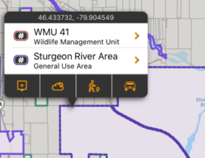
87% of Ontario is made up of public land, and the vast majority of this land is publicly accessible. By taking the General Use Public Land boundaries of Ontario and subtracting out the boundaries of all private land, parks, protected areas, reserves and other federal land, we derived the ‘General Use Crown Land layer’.
There may be additional access restrictions on this land that are not documented in openly available GIS layers, and it is the user’s responsibility to obey all posted restrictions in the field. Although we have done our best to ensure this is accurate, discrepancies may exist. This layer should be used as a guideline only.
These boundaries are shown in pale purple on the map, and are built into the app as part of the subscription. They can be used even without cell coverage. Tapping on the area will give additional information about the selected land.
map layer
Private Land
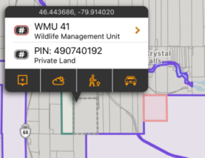
Although making up only 13% of land in Ontario, private land is important because permission is required to access it. Knowing the size and shape of a piece of land makes it easier to discuss with a landowner, and being more informed could help with obtaining permission.
These areas are shown in a grey border with a semi-transparent white filling the areas on the map. Each time a new area of the map is viewed, or a new zoom level is looked at, that portion of the layer needs to be downloaded (requiring cell or Wifi service). Once downloaded, those tiles are cached on device for future offline use.
The private property boundaries in Toronto, Markham, Vaughn, Brampton and Mississauga are not included in this layer.
map layer
Huntable Public Parks
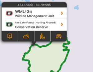
This layer includes the boundaries (and additional information about) Provincial Parks, Wilderness Areas, Conservation Reserves, Forest Reserves, and Far North Protected Areas that allow hunting. Specific rules for both access and hunting may exist. When possible, links to additional content are provided for the specific areas.
These boundaries are shown in pale green on the map, and are built into the app as part of the subscription. They can be used even without cell coverage. Tapping on the area will give additional information about the selected conservation land.
map layer
Municipalities
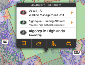
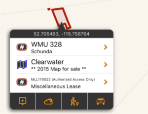
Municipalities have the authority to enforce shooting and hunting restrictions within their jurisdictions. By having these boundaries mapped, you can assess whether you are within the municipal boundary and subject to its bylaws.
They are shown in dark grey on the map, and are built into the app as part of the subscription. They can be used even without cell coverage. Tapping on the area will give municipality name and type.
map layer
Hunting Restricted Public Land
Some land designations forbid hunting by definition. Those area designations included in this layer include some Provincial Parks, Crown Game Preserves, National Parks, National Wildlife Areas, Migratory Bird Sanctuaries, and Other Federal Protected Areas.
This is not a complete listing of every parcel of land the dis-allows hunting, as that is an impossible task. It is merely a visualization of the defined hunting restricted areas as listed above. No-hunting zones described in the Hunting and Trapping Regulations, which do not have digital boundaries published by the province, are NOT included in this layer.
They are shown in pale red on the map, and are built into the app as part of the subscription. They can be used even without cell coverage. Tapping on the area will give the Park name and designation.
map layer
Enhanced Management Areas
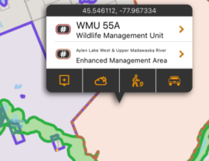
Enhanced Management Areas is a land use category that has been established in order to provide more detailed land use direction in areas of special features or values. A wide variety of resource and recreational users can occur in EMAs. In some areas, specific uses may be subject to conditions that are designed to support the values that make the area special. Enhanced Management Areas may lead to modifications (e.g., timing, location, method, access) in resource-management practices in order to recognize other land use values. In the detailed view of each EMA, you can see whether public access to roads, hunting, fishing, and other activities is permitted
They are shown in orange on the map, and are built into the app and can be used even without cell coverage, however the detailed view of each EMA requires cell coverage or wifi.
map layer
Licenses of Occupation
Thousands of parcels of Public Land in Ontario are subject to Licenses of Occupation (LOC). An LOC gives the licensee certain rights and responsibilities, such as:
- gives the right to use the land for up to 20 years, but does not give ownership of the land
- no extensive and/or valuable improvements to the land can be made
- no future financial or environmental liability is anticipated as a result of the intended land use
- rights granted are transferable, with ministry consent, but there is no right of renewal
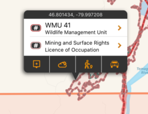
In most cases, these LOCs do not prevent other valid land uses. However, we map these regions as there may be other non-recreational activities taking place. Additional care should be taken if accessing one of these areas, and all signage should be obeyed.
They are shown in pale pink on the map, and are built into the app as part of the subscription. They can be used even without cell coverage. Tapping on the area will give the disposition number, tenure number, or OGF ID.
map layer
Federal Lands
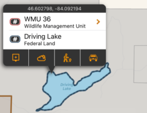
The Federal Lands layer includes Military Bases, Airports, Weather Radar Sites, First Nations Settlements, and Dams. These lands are not publicly accessible for hunting.
This is not a complete listing of every parcel of Federal Land, but is the most accurate data available publicly. Some small island parcels are not included in this layer due to size and performance constraints.
They are shown in navy on the map, and are built into the app as part of the subscription. They can be used even without cell coverage. Tapping on the area will give the land name and type.
map layer
Mining Land Tenure
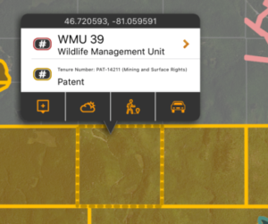
The Mining Land Tenure layer includes surface and mining rights on private or crown land. Surface and mining rights on private or crown land mean that the land is not available for public access. Permissions is required from the leaseholder or private landowner.
They are shown in yellow on the map, and are built into the app. They can be used even without cell coverage.
map layer
Patent Crown Land
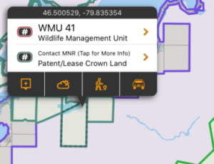
The Patent Crown Land layer consists of parcels of crown land with uncertain access restrictions. These parcels may be used by the province, leased out for exclusive use to third parties, or possibly available for public access.
There may be access restrictions on these land parcels that are not documented in openly available data, and it is the user’s responsibility to obey all posted restrictions in the field. Discrepancies may exist and this layer should be used as a guideline only. You should not assume public access without verifying with the MNR.
They are shown in teal on the map, and are built into the app. They can be used even without cell coverage.
map layer
MNRF Road Segments
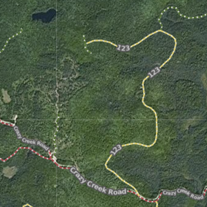
The Ministry of Natural Resources and Forestry Road Segments layer contains MNRF roads that are the linear geometry of the road. It consists of roads that have actually existed as a path supporting conventional four-wheel street legal vehicles. Specifically not to be included are paths constructed for off-road vehicles (e.g. ATV trail) and temporary paths related to forest management (e.g. skidder trail) or forest fire management (e.g. rehabilitated fire trail).
The roads are shown as dashed lines on the map and coloured to indicate their status:
Green indicates open roads.
Yellow indicates restricted roads.
Red indicates closed roads.
Each time a new area of the map is viewed, or a new zoom level is looked at, that portion of the layer needs to be downloaded (requiring cell or Wifi service). Once downloaded, those tiles are cached on device for future offline use.


